GNSS-denied navigation module

The sky lies
Fly anyway

Octant is a bolt-on navigation module that keeps a small uncrewed aircraft on mission when GNSS is jammed, spoofed, or gone. It computes position onboard from what its camera sees — emitting nothing, depending on nothing, and declaring the moment its own fix degrades.

Request a briefingWatch the film
FIG. 01 — OCTANT IN 80 SECONDSAIRCRAFT SHOTS VISUALISE THE CAD  ·  SORTIE DATA IS RECORDED
01

The module

One compact unit on the belly of the aircraft: a global-shutter camera, an inertial unit, and a mission computer. It watches the ground move past, measures the aircraft’s own motion, and solves position continuously — the way a pilot does, with instruments instead of satellites.
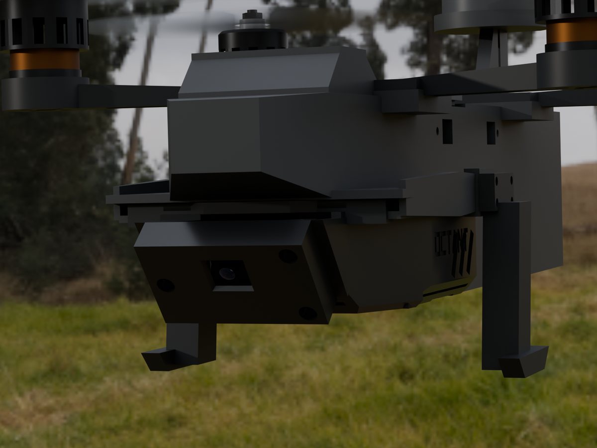
CAD render of the Octant module mounted under the aircraft, camera window at the nose

Sees, instead of listens

Passive vision plus inertial sensing. No RF received, none transmitted — nothing to find, jam, or spoof.

Solves position onboard

The fix is computed on the module itself and fed to the autopilot as a standard position stream. PX4, ArduPilot, Cube-class stacks — no rework of your aircraft.

Declares its own confidence

Every fix carries a live trust measure. If the estimate degrades, the aircraft knows — and executes a defined action instead of drifting on a lie.

Sized for small aircraft

Light, low-power, low-cost, no GPU. Built for sub-25 kg platforms — inspection, survey and delivery fleets as much as defence — at a price that matches the aircraft.
02

How it fights the jam

STEP 01

See

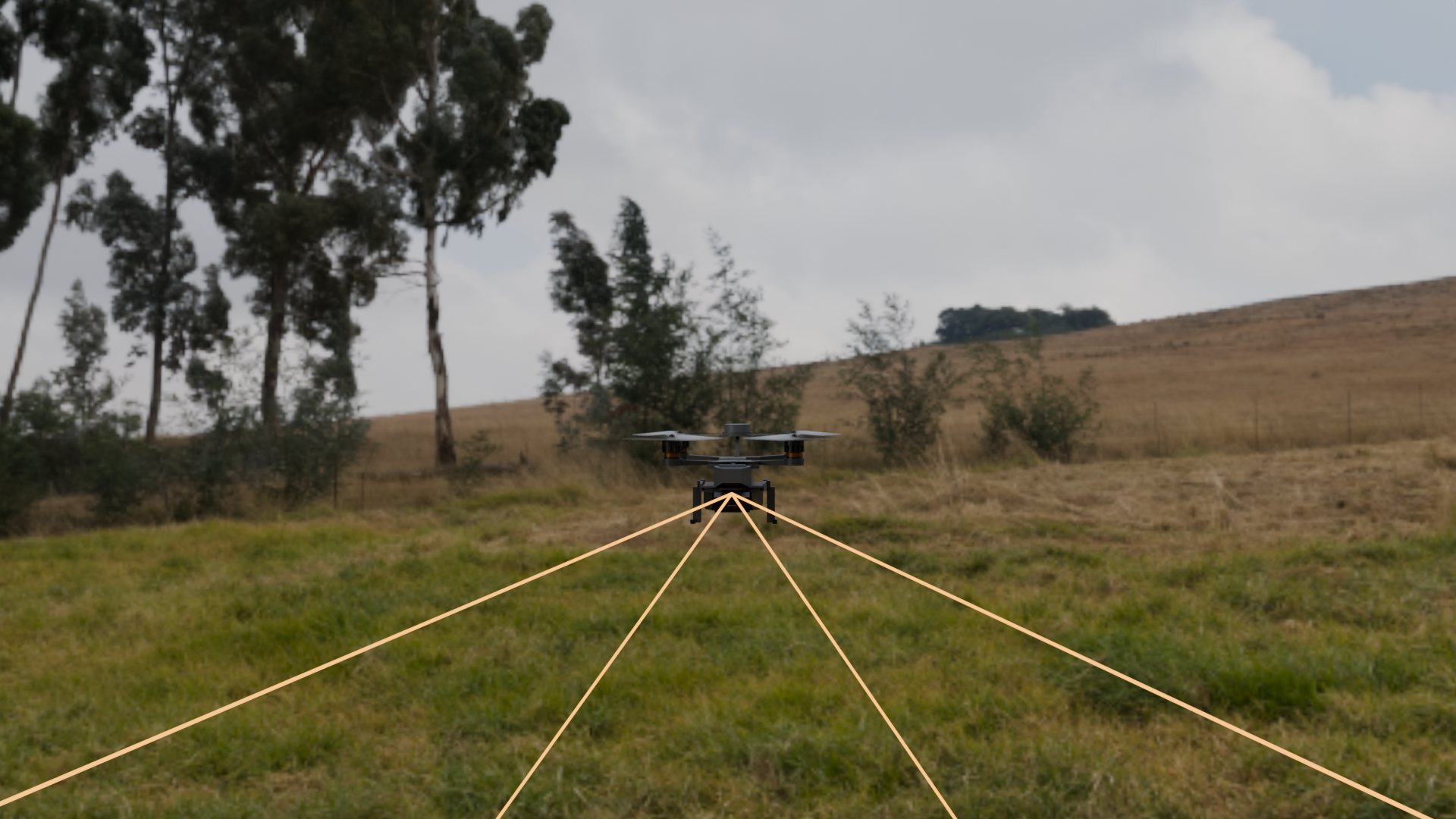
The camera tracks hundreds of ground features as they stream past; the inertial unit measures every acceleration and turn.

STEP 02

Solve

Vision and motion are fused into a continuous position, velocity, and heading — computed entirely onboard, satellites not consulted.

STEP 03

Verify

The estimate is audited in real time. Degrading confidence triggers a defined response: hold, reroute, return, or land.

STEP 04

Feed

The autopilot receives the fix exactly as it would GNSS. Your aircraft flies its mission; it never knows the satellites left.

CAD render: the aircraft over a field with the camera's field of view drawn on the ground
FIG. 02 — WHAT THE CAMERA WATCHES: THE GROUND, NOT THE SKYCAD RENDER
SEE IT RUN · MISSION DEMO — a simulated sortie with GNSS off, on Octant’s own estimate, confidence declared throughout
03

On your airframe

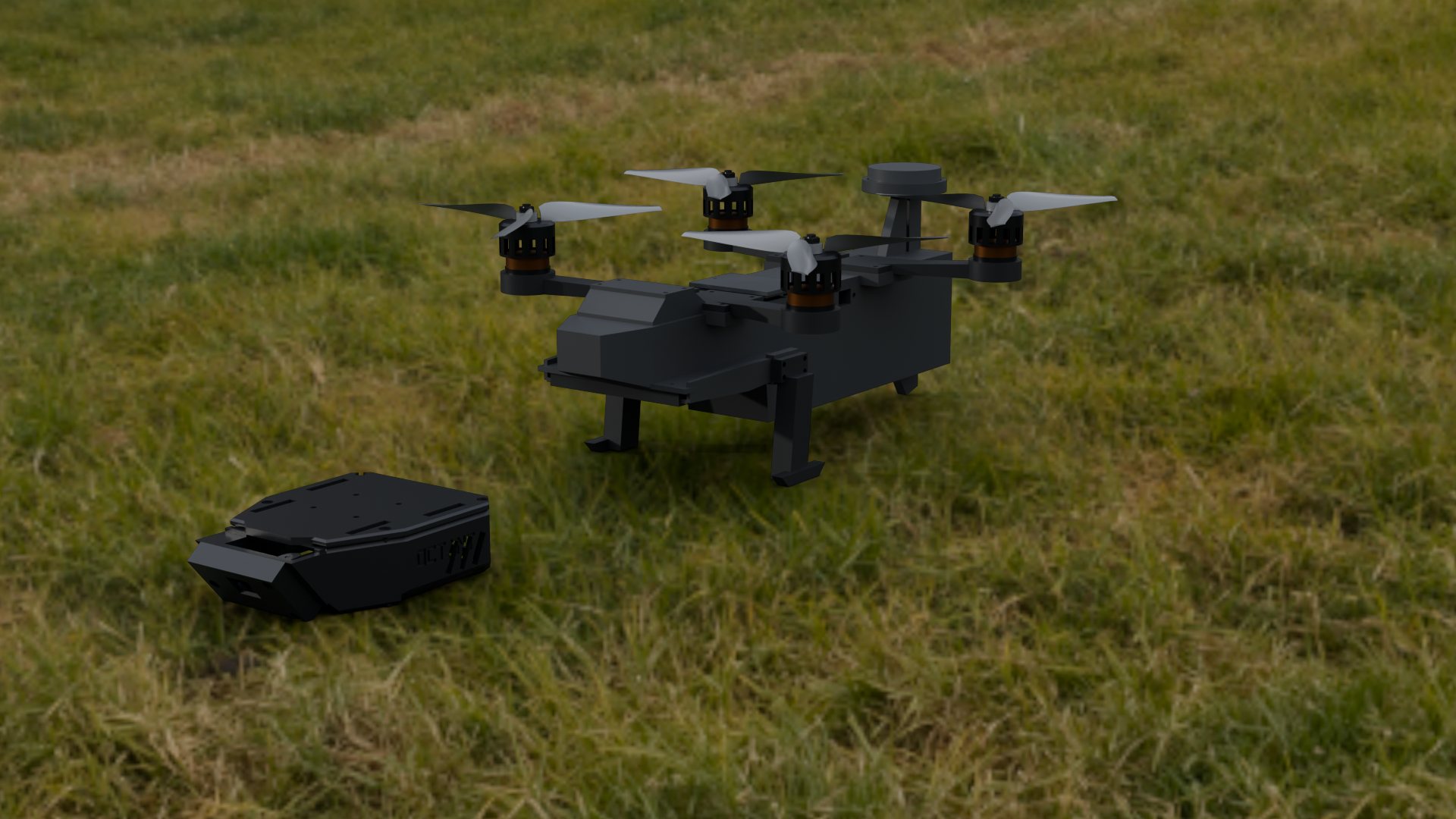
Octant is a payload, not a platform. It mounts to the belly rail of the aircraft you already operate and integrates in a day over a single connector.

CAD render: the Octant module on the grass beside the aircraft it mounts to
FIG. 03 — THE MODULE COMES OFF; THE AIRCRAFT STAYS YOURSCAD RENDER
INTEGRATION · ABOUT A DAYINTERFACE · STANDARD AUTOPILOT LINKAIRFRAME MODS · NONE
04

Restricted data

The numbers are earned
Most stay behind the line

Two results are public because they are measured on open data: the estimator’s drift on the EuRoC benchmark, and its frame time on an £80 CPU. Flight envelope, endurance and accuracy on the platform you intend to fly are disclosed to qualified UK partners under NDA.

Datasheet · OctantRESTRICTED
Benchmark drift · EuRoC MH_010.080 m ATE · 0.10 %
ComputeCPU Only · no GPU
Position accuracy in flight
Mass / power
Mission envelope
Sensor suite
Counter-spoof method
RELEASED UNDER NDA — REQUEST A BRIEFING

Lose the satellites
Keep the mission

For UK integrators and platform builders, defence and civil, who need aircraft that keep flying when GNSS can no longer be trusted.

Request a briefingjonathan@apricotstudio.co